What Is Groundwater, and How Deep Is It?
Many projects focus only on whether the soil is "stiff or soft", yet many site problems — collapsed excavations, voids in bored piles, leaking basement floors — have groundwater as the culprit.
Groundwater is the water held in the voids between soil grains and in rock fractures. The top of the saturated zone is called the groundwater level (water table), and it is not constant — it rises and falls with the seasons, rainfall, water levels in nearby water bodies and groundwater pumping in the area. In many parts of Thailand's Central Plain, the groundwater level is only a few meters below the ground surface.
The figure below summarizes all four effects in a single section: a spread footing placed near the water level, an excavation deeper than the water level, a basement pushed up by water pressure, and piles in groundwater containing corrosive substances.
← Scroll to see the full table →
| Effect | Mechanism | Works at risk | Data needed |
|---|---|---|---|
| Lower bearing capacity | Water pressure reduces effective stress | Shallow spread footings | Water level in boring log |
| Excavation problems | Water seepage, base boiling, running sand | Foundation excavations, basements, bored piles | Water level + soil type (sand) + rainy season |
| Uplift | Water pushes up ≈ 1 t/m² per 1 m of water depth | Basements, water tanks, treatment tanks | Highest expected water level (observation well) |
| Corrosion | Sulfates/chlorides in water and soil | Coastal areas, saline soils, old industrial estates | Chemical tests: pH, sulfate, chloride |
Effect 1: Why Does Groundwater Reduce Soil Bearing Capacity?
Soil carries load through contact between soil grains. When water is present, the pore water pressure "carries" part of the load instead of the soil skeleton, reducing the effective stress actually carried by the grains. By the principle σ′ = σ − u, effective stress equals total stress minus pore water pressure. As a result:
- The bearing capacity of spread footings drops significantly when the groundwater is shallow, close to foundation level (review the concept of soil bearing capacity in What Is Bearing Capacity?)
- Saturated, loose sand is at risk of sudden loss of strength under vibration (liquefaction) during an earthquake — read about the mechanism in detail in Earthquakes and Foundations: Which Soils Are at Risk of Liquefaction
This is why engineers need to know the groundwater level before concluding the allowable bearing capacity of the soil.
Effect 2: What Problems Arise When Excavating Below the Groundwater Level?
- Water flowing into the excavation — requires continuous pumping, slowing work and increasing costs
- Running sand (boiling) — when excavating below the groundwater level in a sand layer, water flowing into the pit can carry sand grains with it until the pit bottom fails or adjacent structures settle
- Bored pile works — high groundwater requires the borehole to be stabilized with a steel casing or a support fluid; otherwise the hole collapses before concrete is placed
- Dewatering — makes excavation possible, but if done without analysis it can cause the surrounding ground to subside and affect neighboring buildings
A foundation excavation that is "easy to dig" in the dry season can turn into a pond in the rainy season because the groundwater level rises — planning excavation works using groundwater data measured only once in the dry season is therefore a risk that must always be allowed for.
Effect 3: How Much Does Uplift Push on Underground Structures?
Structures submerged below the groundwater level, such as basements, underground water tanks or treatment tanks, are pushed up by water pressure (uplift / buoyancy). If the design does not allow for it, the structure may float, the floor may crack or joints may leak — especially while the structure is still empty and lightly loaded. An empty underground water tank is in its own most dangerous condition.
The magnitude of the water pressure is easy to estimate: water pressure increases by about 1 t/m² (approx. 9.81 kPa) per 1 m of depth below the water level. For example, a basement floor 3 m below the groundwater level will be pushed up by about 3 t/m² over the whole floor. The design water level should therefore be the highest level expected in the rainy season, not a value measured once in the dry season.
Effect 4: How Can Groundwater Corrode Foundations?
In some areas the groundwater is high in sulfates or chlorides, such as coastal areas, saline-soil areas or old industrial areas. These attack concrete and accelerate corrosion of reinforcing steel. Where this is suspected, the engineer may specify collecting water or soil samples for chemical testing, such as pH, sulfate and chloride (see water/soil sampling and testing services), to select a suitable cement type and concrete cover (factory projects should check this from the land selection stage — see the soil checklist before buying factory land).
How Do You Find the Groundwater Level? The Role of Soil Investigation
A soil investigation can collect groundwater data at several levels of detail:
- Recording the water level in the borehole — standard data in the boring log, measuring the water level encountered during drilling and after the hole is left for the water level to stabilize
- Groundwater observation well (observation well / standpipe) — a screened pipe surrounded by filter sand and sealed with bentonite is installed in the borehole, following ASTM D5092/D5092M-16(2024), to measure the groundwater level continuously over a long period; suitable for projects that need to know seasonal fluctuations (details in What is a groundwater observation well?)
- Piezometer — an instrument that measures pore water pressure at a specific depth, used in deep excavations, dams or monitoring soil behavior during construction (read What is a piezometer? · real project example Piezometer + Monitoring Well, Samut Prakan · SPN's instrumentation installation services)
The 3D model below compares all three data collection methods on the same soil section, showing that an observation well measures the water level over the screened section, while a piezometer measures water pressure only at the depth sealed off from other layers.
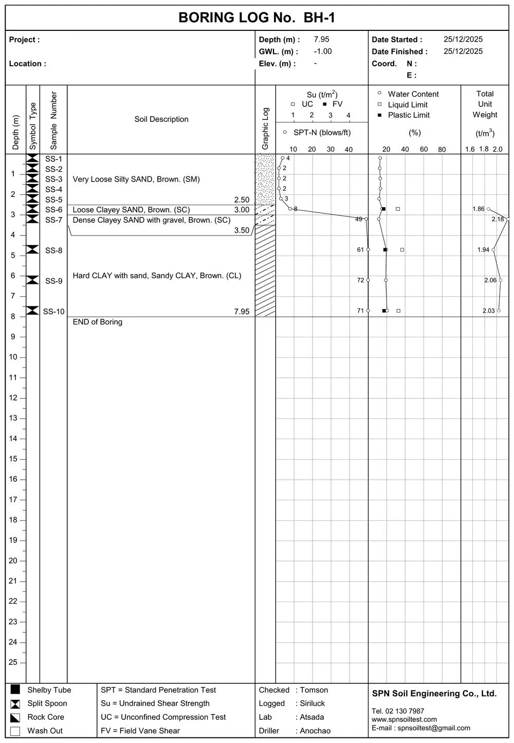
The water level measured on the drilling day is a snapshot of that moment. If a project is sensitive to groundwater, for example with a deep basement, engineers usually recommend installing an observation well to collect data over a longer period, in particular covering the rainy season.
Summary: Don't Overlook the “Groundwater Level” Line
Groundwater is a silent variable that affects soil bearing capacity, construction methods, excavation safety and the long-term durability of the structure. The good news is that this data can be collected along with the soil investigation with almost no extra steps (see the overview of why a soil investigation is needed). Just don't overlook the "groundwater level" line in the boring log, and ask your engineer how detailed the groundwater data for your project needs to be.
This article is provided as engineering knowledge. Analyzing the effects of groundwater and designing protection systems is the responsibility of a licensed design engineer, based on the actual project data.