Home About Services Soil Investigation & Testing Pile Testing Topographic Survey Geotechnical Instrumentation Structural Testing (NDT) Environmental Site Assessment Geotechnical Design Civil & Structural Design Articles View all → ASTM Standards for Soil Boring Thai Foundation Regulation 2023 Interpreting SPT N-values Pile Testing Methods Explained Soil Bearing Capacity Careers Contact · Request a quote
Geotechnical Instrumentation

Geotechnical Instrumentation in Thailand: Settlement, Pore Pressure, Movement

SPN’s instrumentation service covers everything from settlement, pore water pressure and lateral movement to structural load, neighbouring buildings and vibration. We install the instruments, read them on a schedule or in real time through dataloggers, and report the trends with an engineer’s signature. We work nationwide across Thailand from our office in Bang Sao Thong, Samut Prakan, near Bangkok.

  • Nationwide: all 77 provinces
  • Manual or real-time readings
  • Reports signed by a licensed engineer
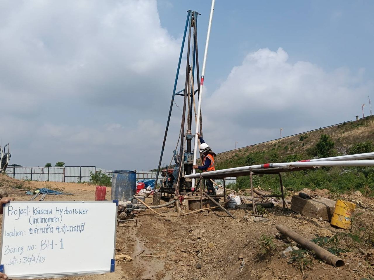
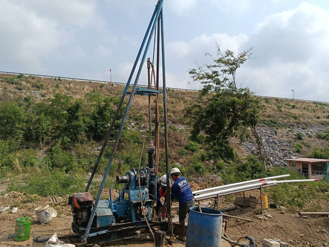
SPN team drilling and installing inclinometer casing in borehole BH-1

Service overview: geotechnical instrumentation and monitoring

Geotechnical instrumentation detects changes in soil and structures that cannot be seen: settlement plates measure settlement, inclinometers measure lateral movement and piezometers measure pore water pressure. Continuous data lets engineers slow down or change the construction method before real damage happens.

Scope

What it covers

  • Settlement: settlement plate · deep settlement · extensometer
  • Water pressure: piezometer · observation well
  • Movement: inclinometer · tiltmeter · total station / prism
  • Structural load, neighbouring buildings, crack meters and vibration (PPV)
When to use

When you need it

  • Deep excavations and retaining walls
  • Embankments and high fills on soft ground
  • Tunnels, piling or construction next to existing buildings
  • Projects with EIA monitoring conditions
Deliverables

What you receive

  • As-built instrument locations and depths
  • Baseline readings and periodic reports with trend graphs
  • Datalogger alerts by LINE / SMS / email when limits are exceeded
  • Summary report signed by a licensed engineer

Settlement monitoring

Settlement instruments track how far the ground and structures settle, from the surface down to deep soil layers, to confirm the design and the progress of consolidation.

  • Settlement PlateA 60×60 cm steel plate placed at the base of the fill with a steel rod extended above the surface, levelled with an auto level at every reading. Used under embankments, roads and preloading/PVD works.
  • Deep / Multi-level Settlement PointPoints anchored at several depths in one borehole show which soil layer is settling most. Suited to soft clay and to confirming consolidation analysis.
  • Surface Settlement MarkerMarkers on the ground, roads and footpaths around an excavation, read against a reference benchmark outside the zone of influence. Used for deep excavations, tunnels and buried pipes.
  • Extensometer (Rod / Magnetic)Measures settlement or heave along a borehole: a rod extensometer anchors rods at several levels, a magnetic extensometer uses magnet rings around a pipe read with a probe. Used at excavation bases, high embankments and tunnels.

Pore water pressure and groundwater

These instruments measure pore water pressure and groundwater level to assess stability and the effect of drainage or dewatering.

  • Standpipe PiezometerThe tip sits in a sand filter sealed above with bentonite, and the water level is read with a water level meter. Low cost and suitable for long-term use.
  • Vibrating Wire PiezometerASTM D7764Fast response and high resolution, and it can be read automatically through a datalogger. Every sensor is checked before installation.
  • Observation WellA screened pipe across the aquifer interval, used to follow seasonal groundwater levels and the effect of dewatering during construction.

Lateral movement and tilt

These instruments measure tilting and lateral movement of soil and structures, giving warning before failure or damage.

  • InclinometerASTM D6230A probe is lowered through inclinometer casing installed in the ground or a wall, reading tilt every 0.5 m to build a displacement profile over the full depth. Used for excavations, retaining walls and slopes.
  • TiltmeterMounted on columns, walls or retaining walls and read with a portable unit, or connected to a datalogger for real-time alerts.
  • Total Station / Prism MonitoringPrism targets on buildings, walls or key structures are surveyed with a total station from reference points, giving X-Y-Z movement.

Load and strain in structures

These instruments measure the actual forces in struts, ground anchors, walls and piles so they can be compared with design values.

  • Strain GaugeWelded or embedded on steel struts, reinforcement or concrete; strain is converted to force using the section properties.
  • Load CellInstalled between a strut head and the waler, or under a ground anchor head, to read force directly without section conversion.
  • Earth Pressure CellA fluid-filled cell connected to a pressure transducer, installed on a wall face or under a foundation to measure total earth pressure.
  • Instrumented PileASTM D1143Strain gauges at several levels plus telltales in a static load test pile separate the shaft friction of each soil layer from the end bearing.

Neighbouring buildings and vibration

This group records the existing condition of nearby buildings before work starts and measures construction effects during the work, to reduce damage and disputes.

  • Pre-construction Condition SurveyPhotos, video and a record of the location and size of existing cracks in buildings around the site, before piling, excavation or demolition.
  • Building Settlement PointPoints fixed to columns or walls of neighbouring buildings, levelled with an auto level against a reference benchmark to assess differential settlement.
  • Crack MeterInstalled across significant cracks and read manually (crack gauge) or as a vibrating wire sensor on a datalogger, to see whether a crack is still opening.
  • Vibration MonitoringNational Environment Board Notification No. 37 (B.E. 2553), DIN 4150-3, BS 7385-2Triaxial geophones at the foundations of neighbouring buildings record peak particle velocity (PPV) continuously during piling, demolition or compaction, compared with the criteria the project specifies.

Automatic reading and alerts

Dataloggers record readings automatically and send alerts when a value reaches a set limit.

  • Automatic DataloggerRecords at intervals from every 1 minute to daily, supports vibrating wire, 4-20mA and RS-485 instruments, and sends data over 4G or WiFi.
  • Real-time AlertMulti-level alert thresholds, with notification by LINE, SMS or email as soon as a value reaches a set level.
  • Cloud Dashboard & ReportThe project team can view graphs at the same time from anywhere and export PDF or Excel reports on the agreed schedule.

Which instrument fits your project?

The table summarises what each common instrument measures, its typical accuracy and where it is used.

InstrumentMeasuresTypical accuracyDataloggerTypical use
Settlement PlateSettlement under fill±1 mmNo (read with auto level)Embankments, preloading
Multi-level SettlementSettlement of each soil layer±1 mmYes (VW sensor)Consolidation analysis
Standpipe PiezometerWater pressure head at one point±10 mmYes (pressure transducer)EIA, long-term monitoring
Vibrating Wire PiezometerPore water pressure±0.1 kPaYes (VW datalogger)Excavations, preloading
Observation WellOverall groundwater level±10 mmYes (diver logger)EIA, environmental
InclinometerLateral movement±0.1 mm/mYes (in-place inclinometer)Excavations, retaining walls
TiltmeterTilt of structures±0.01°Yes (wireless)Real-time alerts
Load CellForce in struts and anchorsAbout ±0.5% of rangeYes (VW datalogger)Struts, ground anchors

Where has SPN installed geotechnical instruments?

Inclinometer · Samut Prakan

Inclinometer behind a sheet-pile wall, deep excavation in Bang Phli

SPN installed an inclinometer in a borehole in the soil behind the steel sheet-pile wall of a deep excavation on soft Bangkok clay. The casing was read through the excavation stages to follow lateral movement of the soil behind the wall.

  • Steel sheet-pile wall
  • Soft Bangkok clay
  • Read through excavation stages
Full case study (Thai) →
Deep settlement points · Bangna

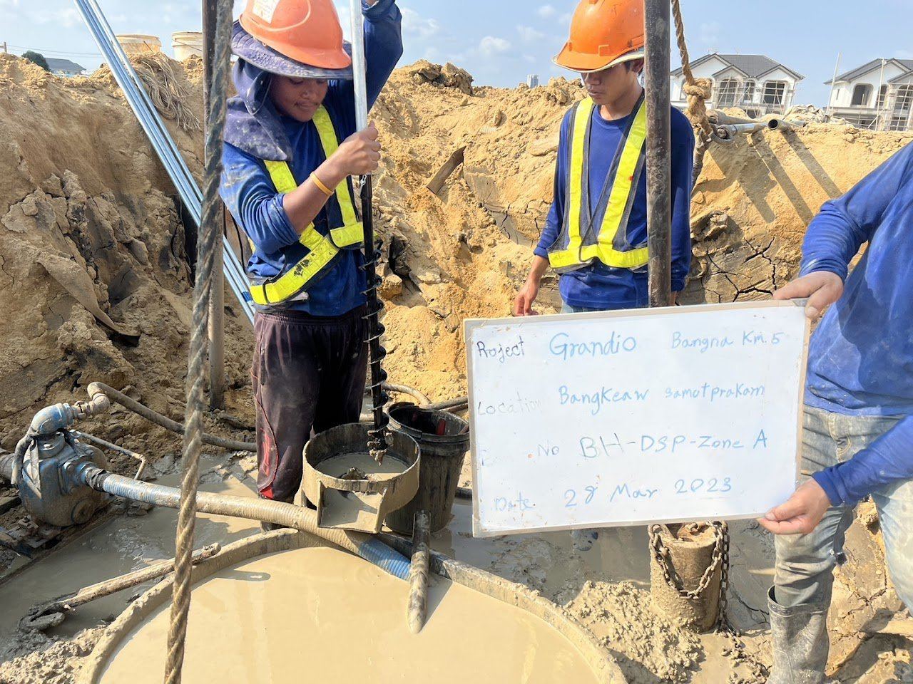
Deep settlement points at Grandio Bangna Km.5

SPN installed deep settlement points in borehole BH-DSP on soft clay. The points measure the settlement of individual soil layers at several depths.

  • Borehole BH-DSP
  • Layer-by-layer settlement
  • Soft clay
Full case study (Thai) →
Piezometer · Samut Prakan

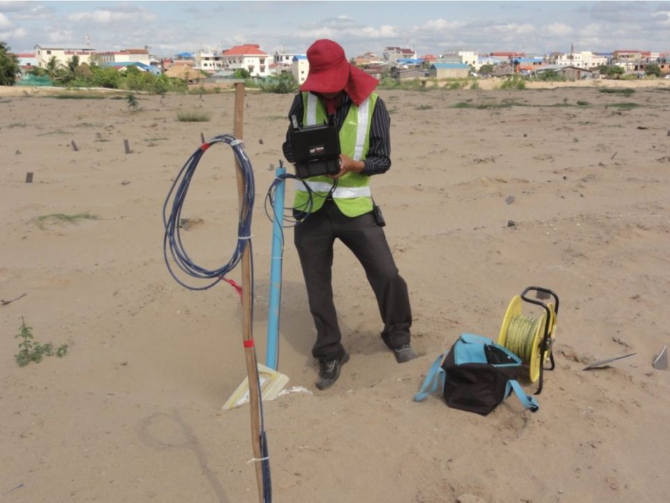
Standpipe piezometer and monitoring well in Samut Prakan

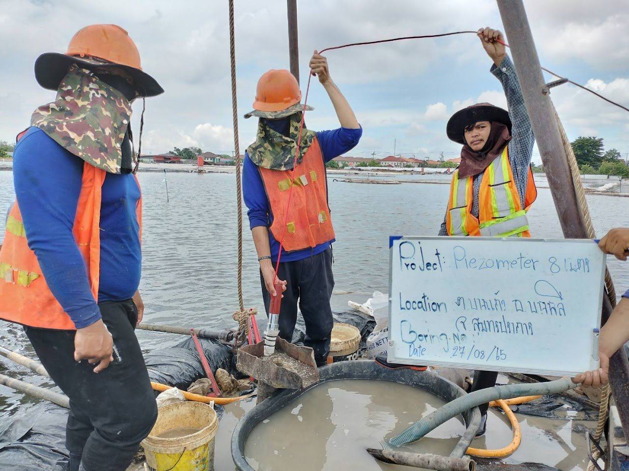
SPN installed a standpipe piezometer with its tip at 8 m, paired with a monitoring well. Both are read monthly to build groundwater level and pore pressure records.

  • Piezometer tip at 8 m
  • Paired monitoring well
  • Monthly readings
Full case study (Thai) →
Inclinometer · Suphan Buri

Slope inclinometer at Kraseaw Hydropower, Dan Chang

SPN drilled borehole BH-1, installed inclinometer casing to ASTM D6230 and took baseline readings. The installation monitors slope movement in hillside colluvium over weathered rock.

  • Borehole BH-1
  • ASTM D6230 casing
  • Baseline readings taken
Full case study (Thai) →

Site photos from SPN projects

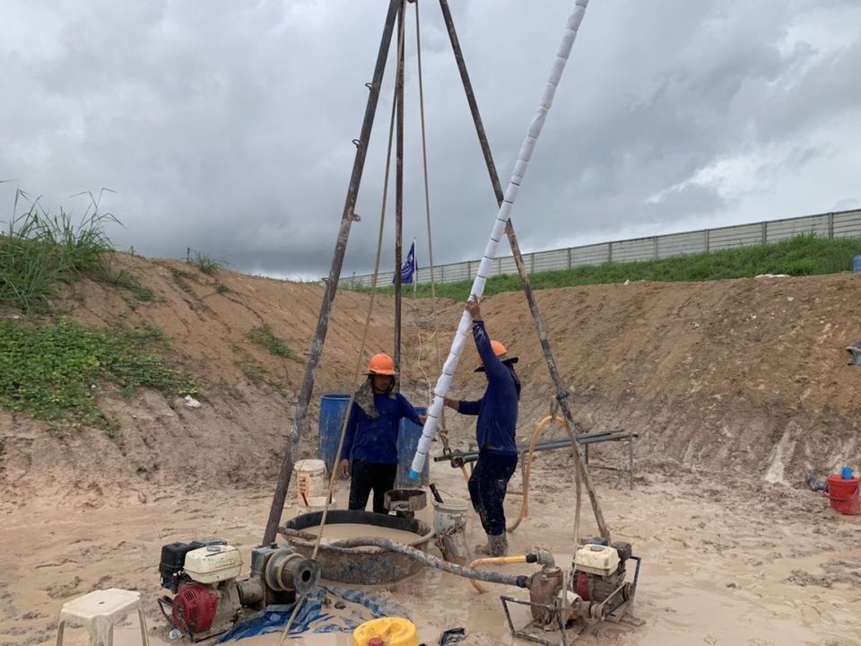
SPN crew drilling and installing a monitoring well pipe
Drilling and installing a monitoring well
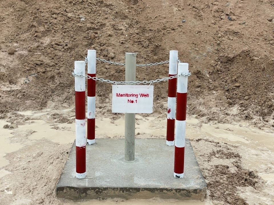
Completed Monitoring Well No.1 installed by SPN
Monitoring Well No.1, completed
8 m piezometer installation by SPN in Samut Prakan
Piezometer 8 m, Samut Prakan
Reading groundwater level in a piezometer
Groundwater level reading
Deep settlement points for layer settlement at Grandio Bangna Km.5
Deep settlement points, Grandio Bangna Km.5
Installing inclinometer casing at Kraseaw Hydropower
Inclinometer casing, Kraseaw Hydropower

How does an instrumentation project with SPN work?

  1. Send project informationSend the construction drawings, site plan, soil investigation results and monitoring requirements (specification, TOR or EIA conditions) by LINE or email.
  2. Plan instrument types and locationsOur engineers propose instrument types, number of points, depths and reading frequency together with the designer, along with a quotation.
  3. Install and record as-built dataInstruments are installed at the approved locations, and the actual coordinates, elevation and depth of every instrument are recorded.
  4. Take baseline readingsReadings are taken several times before construction starts until they are stable. This baseline is the reference for all later changes.
  5. Read on schedule or automaticallyReadings are taken daily, weekly or monthly as planned, or through a datalogger with alerts when a value reaches a trigger level.
  6. Report and engineering interpretationPeriodic reports with trend graphs are compared with the trigger levels, followed by a final summary report signed by an engineer. Trigger levels (normal, Alert, Action) are set by the designer or project consultant; SPN sets them in the system and reports at once when a reading reaches one.

What do you receive?

  • As-built records with the coordinates, elevation and installed depth of every instrument
  • Baseline readings taken before construction starts
  • Periodic reports (daily, weekly or monthly) with trend graphs compared against Alert and Action levels
  • Engineering interpretation and recommendations
  • Immediate notification when a reading reaches a trigger level (LINE, SMS or email on automatic systems)
  • Cloud dashboard access and PDF or Excel report exports for automatic systems
  • Pre-construction condition survey report with photos, video and a survey point plan, where included
  • Final summary report at the end of monitoring, signed by a licensed civil engineer (Council of Engineers Thailand licence)

Why work with SPN in Thailand?

Coverage
Nationwide, all 77 provinces of Thailand. Office in Bang Sao Thong, Samut Prakan, near Bangkok and Suvarnabhumi Airport.
Scope
Testing, investigation and engineering design only. SPN does not take construction work, so recommendations stay independent.
Reports
Signed by a licensed civil engineer (Council of Engineers Thailand licence) and usable for Thai building permit submissions.
Language
Quotations and coordination in English or Thai.
Quotation
Free quotation within 24 hours. Send drawings, site location or TOR to info@spnth.com or LINE @spnth.

Frequently asked questions about geotechnical instrumentation

What is geotechnical instrumentation?
Geotechnical instrumentation is the installation of instruments that measure how soil and structures behave, including settlement, pore water pressure and lateral movement. The data confirms the design, gives early warning and supports EIA reporting.
What is a settlement plate used for?
A settlement plate measures settlement of the original ground under fill. It is a 60×60 cm steel plate placed on the original ground before filling, with a steel rod extended above the fill surface. It is used under embankments, roads and preloading projects on soft clay, and is levelled with an auto level at every reading.
What is the difference between a piezometer and an observation well?
A piezometer measures pore water pressure at a specific depth, while an observation well measures the overall groundwater level of a soil layer. Piezometers are either standpipe (lower cost) or vibrating wire (higher accuracy, datalogger-ready). Observation wells suit long-term monitoring and EIA work.
How does an inclinometer work?
An inclinometer measures tilt and lateral movement with depth. A probe is lowered through ABS casing installed in the ground and records the tilt every 0.5 m. The readings are used to calculate a displacement profile over the whole casing, giving warning before failure.
Is a vibrating wire piezometer better than a standpipe piezometer?
A vibrating wire piezometer is more accurate, responds faster and can be read continuously through a datalogger with automatic alerts. A standpipe piezometer costs less but is normally read by hand (a pressure transducer can be added for automatic reading). In clay it responds more slowly, because water must flow in and out of the pipe (time lag).
How does a datalogger work, and can it send alerts?
Yes. A datalogger records readings automatically at the set interval and sends the data over 4G or WiFi to a cloud server. Thresholds can be set so that SMS, LINE or email alerts go out automatically when a value exceeds a safe limit, and several instrument types can be connected at once.
Should instruments be installed before or during construction?
Instruments should be installed before construction starts, so baseline readings of the soil and groundwater can be taken under normal conditions. Monitoring then continues during and after construction, so changes can be compared and project decisions are based on data.
Which standards does SPN follow for instrumentation?
Inclinometer monitoring follows ASTM D6230, and vibrating wire piezometers are checked before installation to ASTM D7764, together with the instrument manufacturer's manuals. Instrumented piles are load tested to ASTM D1143. Work is supervised and results are certified by a licensed civil engineer (Council of Engineers Thailand licence).
What criteria are used for construction vibration monitoring?
Vibration is assessed against National Environment Board Notification No. 37 (B.E. 2553), or DIN 4150-3 / BS 7385-2 when the project specification requires it. SPN installs triaxial geophones on the foundations or structure of neighbouring buildings and records peak particle velocity (PPV, mm/s) together with frequency.